Click image to open full size in new tab
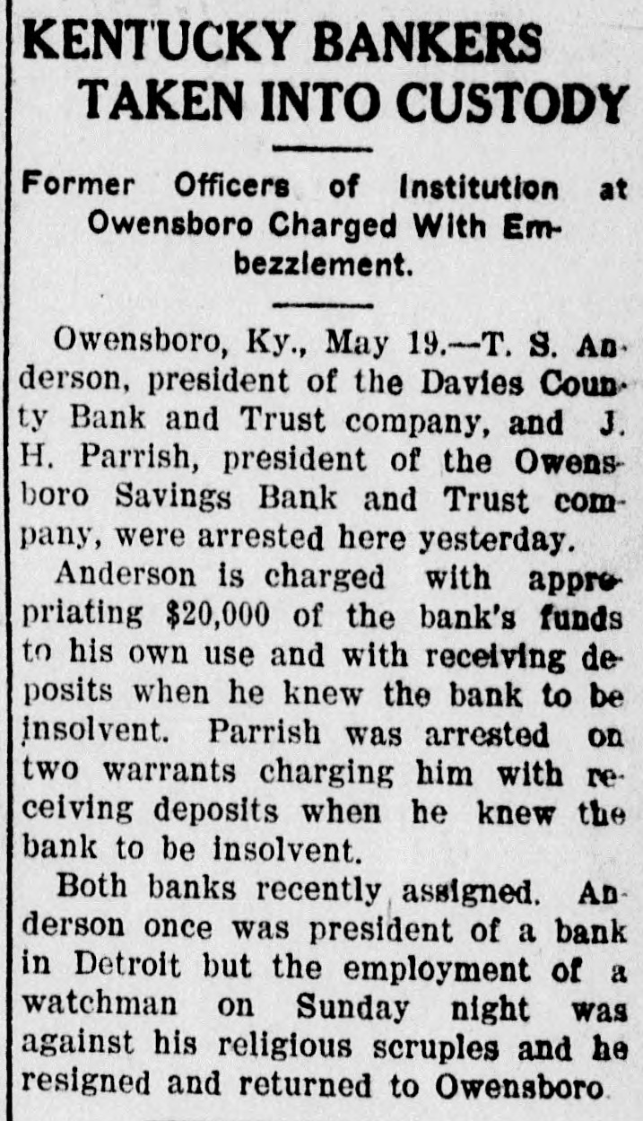
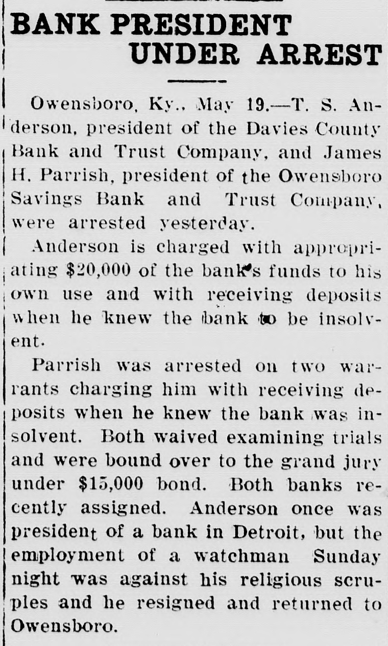
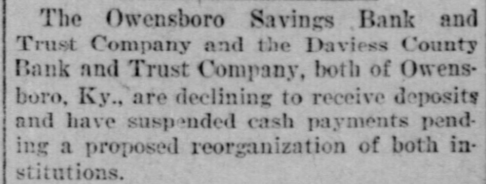
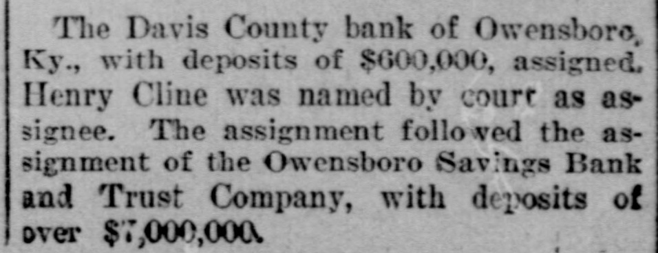
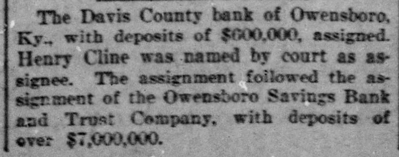
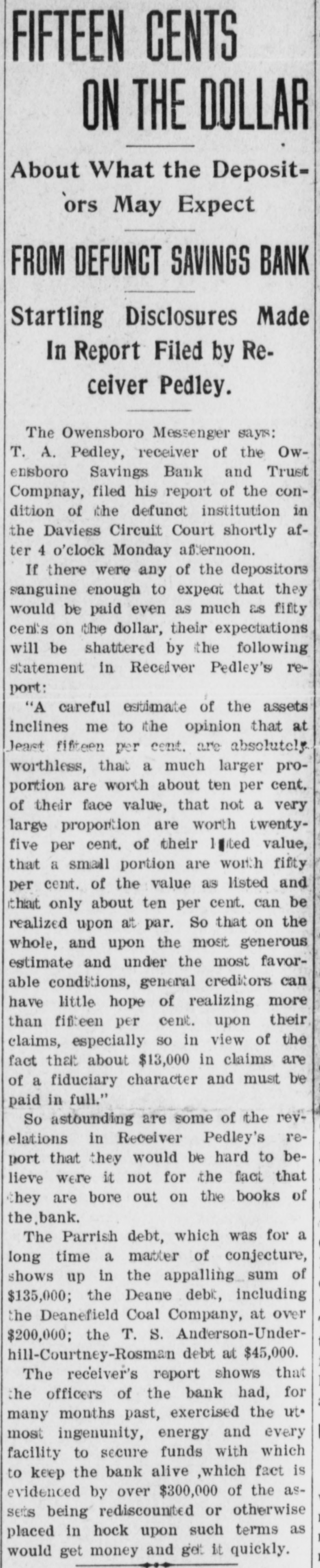
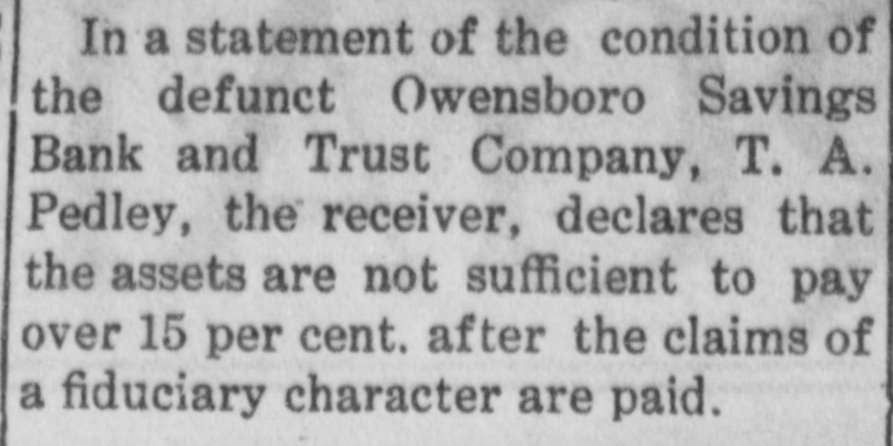
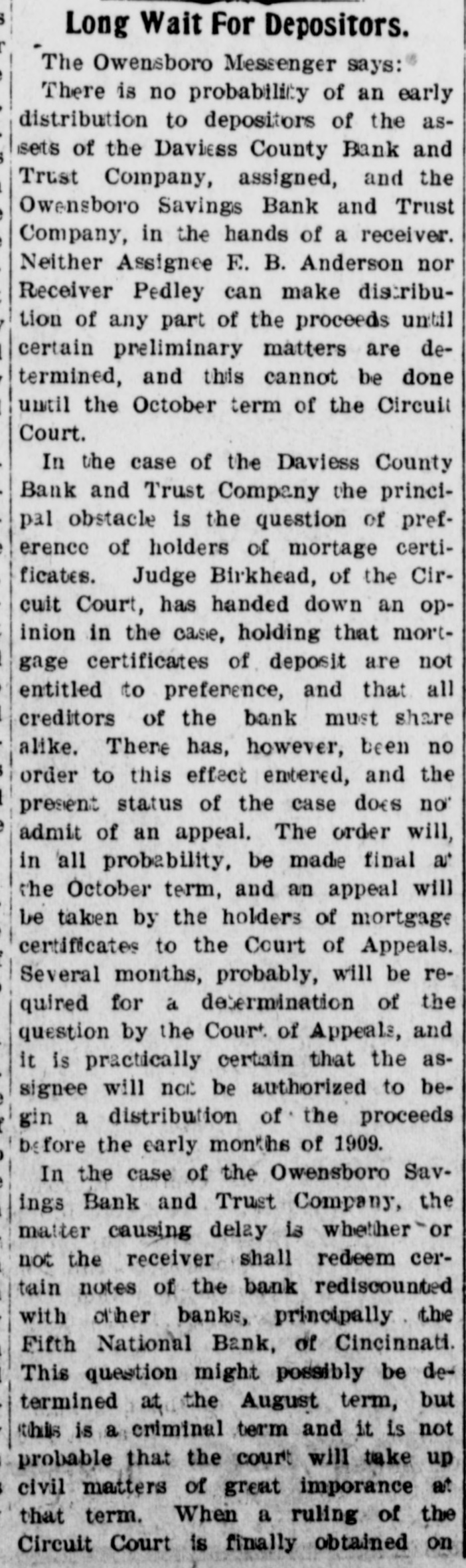
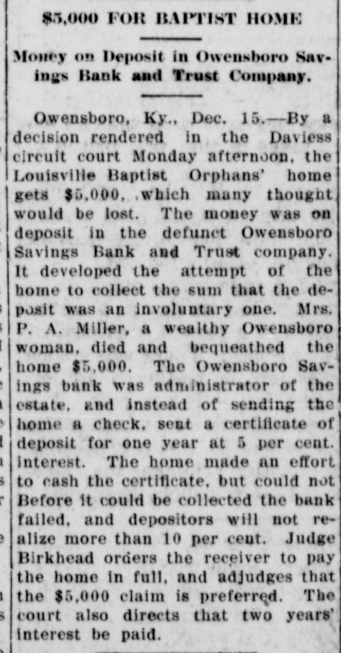
Article Text
# Sheriff's Sale.
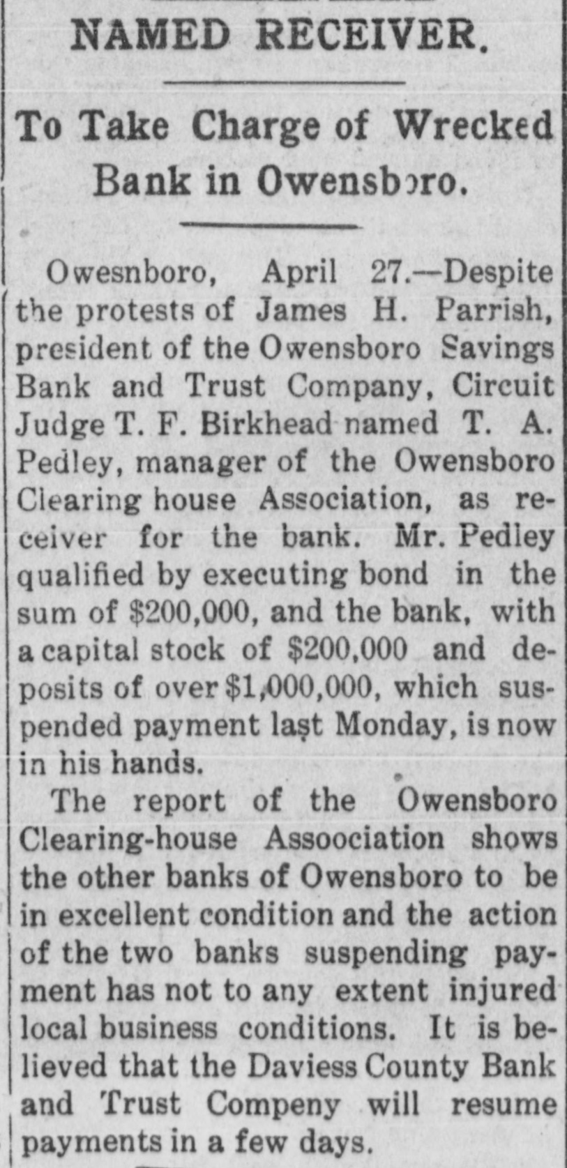
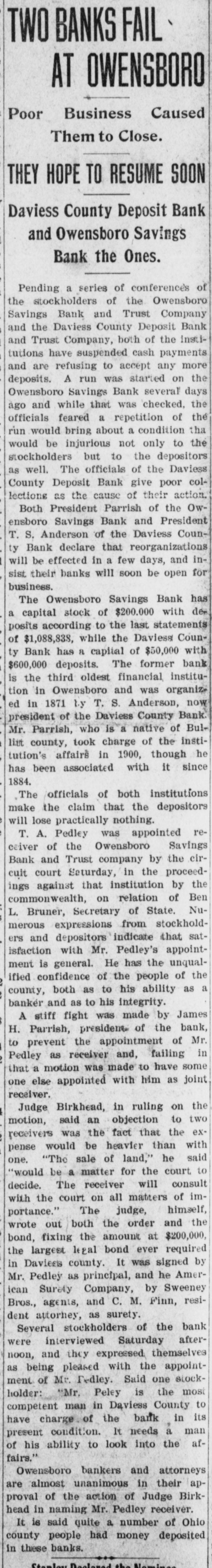
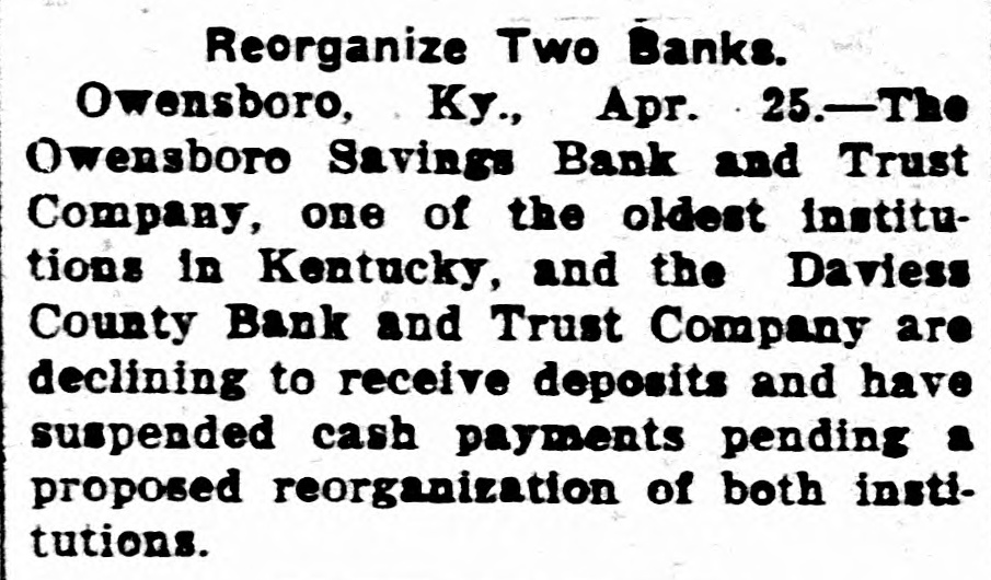
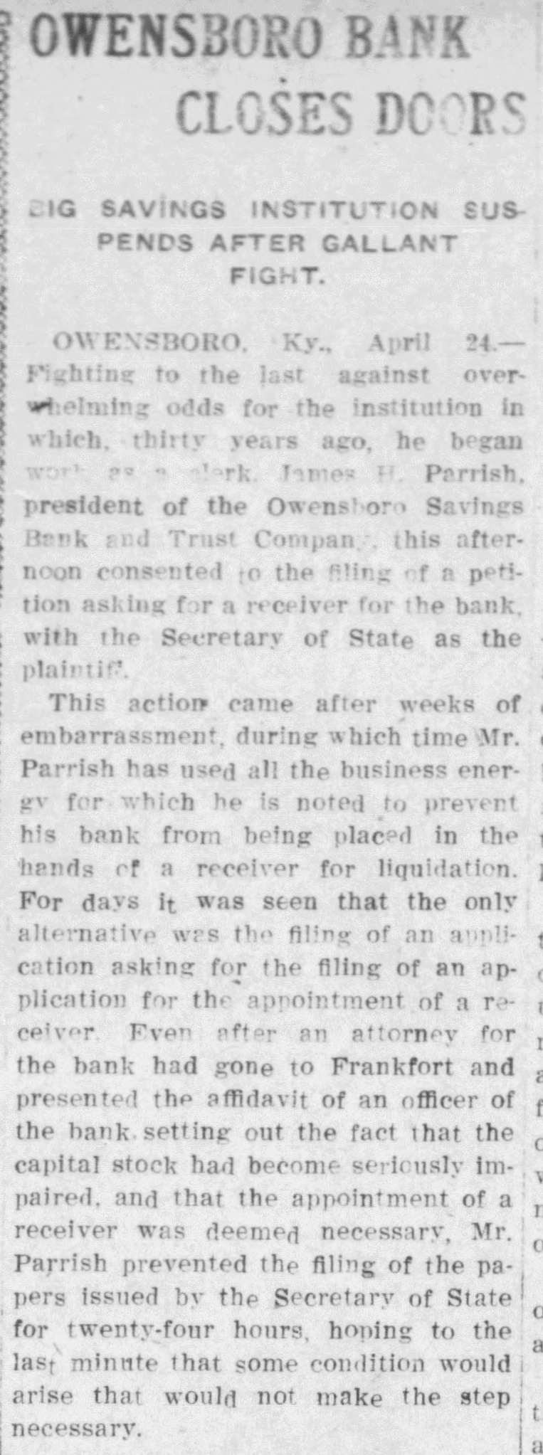
By virtue of an execution issued from the Daviess Circuit Court in favor of T. A. Pedley, receiver of the Owensboro Savings Bank and Trust Company, vs. H. A. Williams, I or one of my deputies will on Monday, May 5, 1913, between the hours of 10 a. m. and 3, p. m. at the Court House Door in Hartford, Kentucky, offer for sale the following real estate situated in Ohio County, Kentucky to satisfy the above execution, amounting to $349.20 with interest at the rate of 6 per cent from April 10, 1905, and also the further sum of $9:45 adjudged as costs.
First-Beginning at a stone in S. J. Baker's line-Black Oak Sapling marked as a pointer. Thence North 36, East 57 poles to a stone in H. B. Taylor's survey, small post, oak, 8 feet from stone marked as a pointer. Thence with said Taylor's line South 80, West 51 poles to a stone Chestnut and Hickory marked as a pointer containing 25 acres.
Second-Also a tract of 10 acres more or less in the same county and state and bounded as follows: Beginning at a stone in the Cromwell and Hardinsburg road, a white oak one pole West of same marked as a pointer. Thence South 74, East 43 poles to a post oak corner to J. P. Nelson's tract. Thence South 8 1-2 East 25 poles to a stone, white oak and black oak marked as pointer. Thence west 54 poles to a stone in the center of the Cromwell and Hardinsburg road, and with the same North 12, East 37 1-2 poles to the beginning, containing 10 acres, more or less, and being the same two tracts of land conveyed to S. J. Baker by W. A. Fielden and J. P. Fielden, his wife, on the 10th day of October, 1892, by deed of record in the Ohio County Court Clerk office in deed book No. 13, page 331, and the same tract afterward on the — day of — sold and conveyed by the said S. J. Baker and wife to the defendant, H. A. Williams, but no record of said deed of conveyance can be found in the Ohio County Court Clerk office.
Third-Also a certain tract of land lying on the head waters of McGrady creek in Ohio county, Kentucky, and bounded as follows: Beginning at a black oak in Peach's line; thence South 39 1-4, East 26 poles to a stone, thence South 75 3-4, East 20 poles to a black oak. Thence South 72 1-2, East 30 poles to a Chestnut and Gum on a branch. Thence down said branch with its meanders to Adam line North 38, West 32 poles to a Schroader's line, thence with said line North 38, West 32 poles to a black oak on Sugar Grove branch, thence up said branch with its meanders to a poplar and beech-Chapezo and Clements corner-thence with this line North 56 West 94 poles to a post oak, Peach's corner, thenge South 8 1-2, East 61 poles to a hickory and red oak, thence South 53, West 60 poles to the beginning, containing 130 acres, less the amount of said land gained in the Ohio Circuit Court by G. W. Clements, supposed to be about 20 acres, and being the same tract of land conveyed by Mathias Miller and others to said, S. J Baker on the 21st day of January,